
PowerPoint maps
Maps made for PowerPoint.
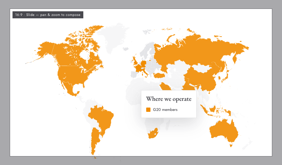
A 16:9 frame shows exactly what your slide will get. Compose the map inside it, export a transparent 3200 px PNG, and drop it straight in.
Create your PowerPoint map →Free to start, no sign-up. Runs in your browser.
The problem
PowerPoint’s own maps aren’t built for this.
PowerPoint’s map charts are for data series, not for “make these 12 countries our blue.” And pasted screenshots turn to mush on a conference-room screen.
Mappeus exports a 3200 px transparent PNG framed for 16:9 — crisp at full-screen, sits on any slide background, no cropping in PowerPoint needed.
How it works
Composed for the slide, not cropped after.
Pick PowerPoint as the destination
A 16:9 frame appears on the canvas — pan and zoom the map under it to compose your slide.
Color your countries
Brand colors, themes, borders, labels, legend — everything you see in the frame exports.
Export and drop it in
One click exports a transparent 3200 px PNG. Insert → Picture, and the map fills the slide perfectly.
Use cases
The slides this fixes.
- 01“Where we operate” and market coverage slides
- 02Sales territory and region-owner slides
- 03Expansion roadmap and launch-plan slides
- 04Any slide where the map is currently a screenshot
Why Mappeus
Built for the map, not the software.
Faster than design tools
No layers to ungroup, no countries to hunt for. Select, color, export — minutes, not hours.
Looks intentional by default
Hand-crafted map geometry, curated themes and precise brand colors keep every export presentation-ready.
The right file, automatically
Pick where the map is going — Mappeus prepares the correct format, size and resolution for that destination.
Everything stays editable
SVG exports keep every country as a separate named layer for Figma, Illustrator, Sketch or Affinity.
FAQ
Good questions.
What resolution does the PowerPoint export use?
3200 px wide — comfortably sharp for full-screen 16:9 slides on 4K displays and projectors.
Will it match my slide background?
Yes — use a transparent canvas and the PNG keeps transparency, so it sits on white, dark or branded backgrounds alike.
Does it work for Google Slides and Keynote too?
Yes — both have dedicated export destinations with the right sizes; the workflow is identical.
Can I edit the map after inserting it?
To change colors or countries, re-open Mappeus, adjust, and re-export — it takes seconds. For vector editing, export SVG instead.
Start now
The map slide, solved.
Open the editor with the PowerPoint destination and 16:9 frame pre-set.
Free to start, no sign-up.