
Sales territories
Territory maps your whole team reads at a glance.
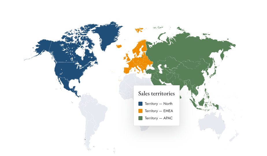
Color countries by territory, name each one in the legend, and export a map that makes ownership obvious — for kickoffs, QBRs and comp plans.
Map your territories →Free to start, no sign-up. Runs in your browser.
The problem
If the territory map is ambiguous, the pipeline argument is coming.
Territory disputes start with unclear maps. A spreadsheet of country lists doesn’t stick — a colored map does. But drawing one in slides means fiddling with shapes nobody wants to maintain.
In Mappeus each territory is a color group: select the countries, pick the team’s color, name the group, and the legend updates itself. Re-cutting territories next quarter is a five-minute edit, not a redesign.
How it works
One color group per territory.
Pick a territory’s countries
Click, search or paste the country list for the first territory — continents and regions are one click.
Assign the team color
Give each territory its own color — exact HEX if you match a CRM or brand palette.
Name it in the legend
“EMEA — Ana”, “APAC — Marcus”… the legend builds itself as you go, then exports with the map.
Use cases
Where territory maps land.
- 01Sales kickoff and QBR decks
- 02Territory planning and comp documentation
- 03Partner and reseller coverage maps
- 04Customer-facing “your account team” pages
Why Mappeus
Built for the map, not the software.
Faster than design tools
No layers to ungroup, no countries to hunt for. Select, color, export — minutes, not hours.
Looks intentional by default
Hand-crafted map geometry, curated themes and precise brand colors keep every export presentation-ready.
The right file, automatically
Pick where the map is going — Mappeus prepares the correct format, size and resolution for that destination.
Everything stays editable
SVG exports keep every country as a separate named layer for Figma, Illustrator, Sketch or Affinity.
FAQ
Good questions.
Can I split the world into custom territories?
Yes — territories are just color groups. Any set of countries can be a territory, and single countries can move between groups with a click.
Can each territory have a label?
Yes — name every color group and the on-map legend lists them; drag it wherever it reads best.
How do I update the map next quarter?
Recolor the countries that changed hands — the legend follows automatically. Export again and replace the slide.
What if my territories are within one region?
Zoom into any continent or region and export just that view — the “On screen” export area captures exactly what you framed.
Start now
Settle the territory map today.
Open the editor with a corporate theme and map your first territory.
Free to start, no sign-up.